Interactive Maps Are a Powerful Tool for Beach Communities, Helping Visitors, Businesses and Organizations
Summer is in full swing and that means people are heading to the beach to enjoy the summer sun. Almost 100 million Americans are taking a family trip this year and 68% of those vacations will be this summer. And half of the most popular destinations are located near a beach – Kissimmee, Florida; Miami; San Diego; Honolulu; and Playa del Carmen, Mexico.
No matter big or small, beach communities always have a lot to offer beyond the beach. Shopping and retail centers, restaurants, lodging, activities and amenities are a few of the non-beach offerings these communities offer. Because after all, not everyone wants to go to the beach, and many people prefer only to spend an hour or two there, then go do something else. But with the sheer amount of foot and car traffic in a concentrated area, it’s important to give people the tools they need to plan our their day.
Mobile-friendly interactive maps are a powerful yet simple way for visitors to navigate their way around town. These maps can be pulled up on mobile devices before and during their visits – which can help them plan beforehand, navigate in real time, and learn more about the area in the meantime. Digital maps are perfectly suited for this purpose because people inherently understand them, and many people enjoy exploring via map to see what else is nearby and get some fun ideas for activities.
Here are several ways that an interactive map can help make beach vacations more relaxing for visitors and more organized for beach town businesses.
Beaches
Do you have a dog? Or kids? Or are you looking to catch some waves and surf? People come to the beach for many different reasons and may have different needs. Certain beaches have rules or are better suited for different activities.
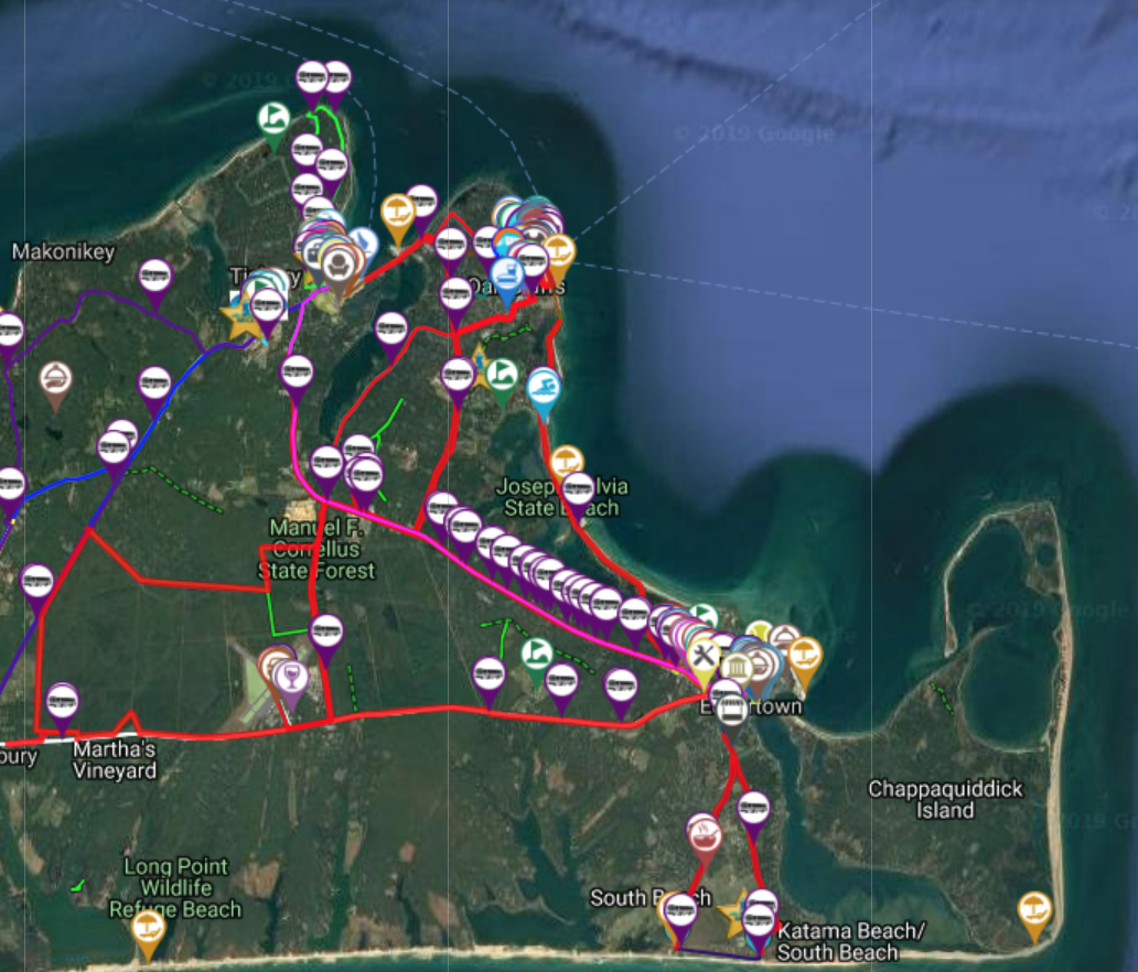
For example, Martha’s Vineyard is a very popular tourist destination with many different beaches. On its interactive map, the beaches tab is sectioned out into three categories, beaches that allow dogs, family-friendly beaches, and beaches that are good for surfing. Having these specific classifications can help visitors save time and make their way to a beach option that is best for their situation.
Interactive maps can also be used to provide information about the surf, such as information about dangerous tides, so people know what to expect (and where not to swim) when they arrive. Other useful applications include finding restrooms, emergency services, and on-beach vendors.
Nearby Shops, Restaurants, and Activities
Laying on the beach isn’t the only thing that tourists can enjoy in a beach town. Many of these communities have many places to shop and restaurants to eat at as well as land and water activities, such as boat tours, fishing charters, golf courses, movie theaters and arcades. Interactive maps can help showcase all of these different offerings in the area, helping visitors to get around as well as promoting the local business economy. Local shops and attractions can be labeled on an interactive map, helping users find the closest options to them and additionally, walking directions can assist users in getting to and from different areas of the town.
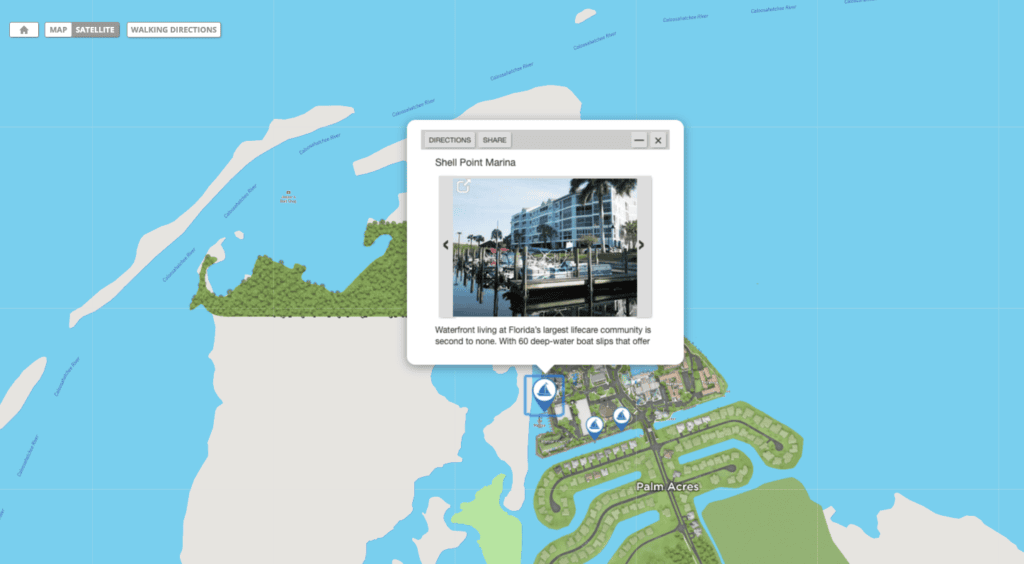
For example, Shell Point is a retirement community on the shores of Fort Myers Florida. This community’s interactive map has specific information on the various dining options and nearby activities including golf, boating, and swimming pools.
Parking
Parking at the beach can be one of the most difficult parts of what is supposed to be a fun and relaxing day. Street parking is often limited and fills up quickly, as do nearby lots. Some local businesses offer their parking to beach goers but there are often many places that visitors can get towed or ticketed if not parked correctly.
With the assistance of an interactive map, parking near the beach can become more simple. All parking options in the area can be highlighted with information on how many spots are available and any fees associated with the space. Additionally, beach towns can go a step further and use digital maps to track open parking spaces across the area. By using connected sensor systems, real-time parking availability within an area can be tracked and then visualized on a map. Even simpler, specific parking areas can be shown on the interactive map and map users can get driving directions directly.
Getting Around
Because parking is so difficult within these areas, tourists may opt to use different forms of transportation to get to the beach. Visitors may bike, use public transportation, or a ride sharing app to get from one place to another.
Martha’s Vineyard’s map includes extensive information on all forms of transportation for tourists. The map includes bike routes & shops, taxi information, as well as trolley and public transportation options. Additionally, interactive maps can integrate real-time transportation tracking information. These systems can show the estimated arrival time of the next shuttle, where stops are, and other information. Designated ride sharing pick up and drop off locations can also be clearly labeled on the map.
For Businesses, Services, and Organizations
Businesses and local organizations can also use maps to provide information about fun activities, deals, and more. Services and organizations, from emergency needs to boards of tourism and municipal departments can also use interactive maps to encourage visits, highlight local events and help secure sponsorships.
Beach communities and the tourism industry can benefit from the many options interactive maps have to offer to visitors.