At Concept3D our goal is to help our customers better serve their audiences with interactive maps and virtual tours. Our platform is extraordinarily flexible and can be tailored to the specific needs or wants of our clients.
One of the features that makes our platform stand out is the ability to integrate new and existing third-party data feeds. From live bus movement to camera feeds to find the shortest line, our software is built with flexibility in mind for higher education, but also serves our clients in business, hospitality, event locations and convention centers, among other industries.
Below are some examples of live data integrations that our clients are currently using:
Live Cameras
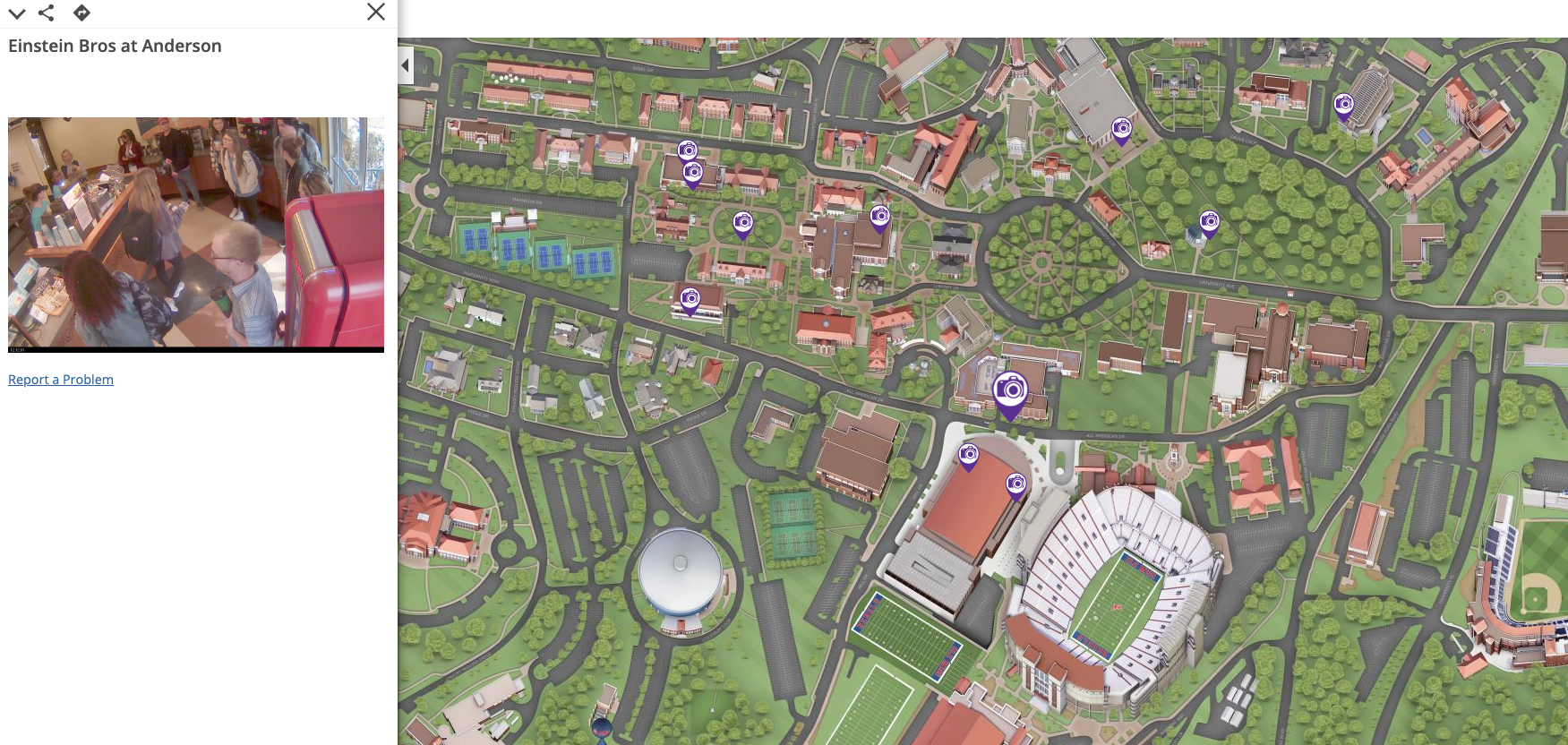
College campus maps are not just for visitors but also for current students and staff. The University of Mississippi does an expert job of making their interactive map for both which is evident by the hundreds of people using the map daily. Ole Miss’s interactive map has 14 live feed cameras all over the busy campus. One of the most popular shows the length of the line at the coffee shop, so people can quickly decide if they have an extra 5 or 10 minutes to get that Pumpkin Spice Latte. Live camera feeds also highlight on-campus restaurants, construction areas, convenience stores, and major thoroughfares of campus. Not only are these cameras helpful for students trying to find the shortest line to grab lunch in between classes but it also helps logistically with traffic flow.
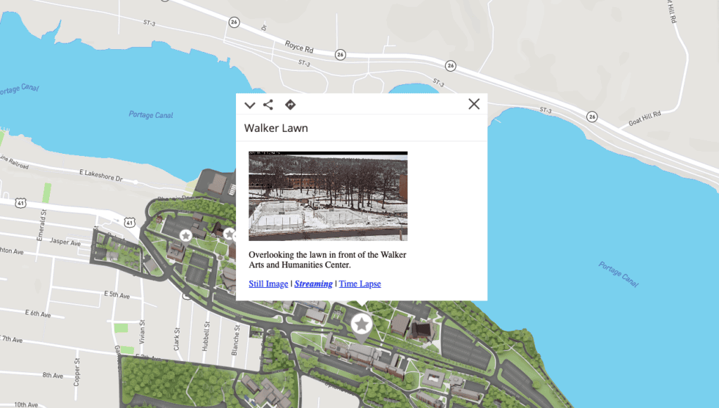
Michigan Tech University also uses live camera feeds across campus, which serve to help prospective students, parents and others really get an accurate feel for campus activity and what life is like at MTU.
Live Transit
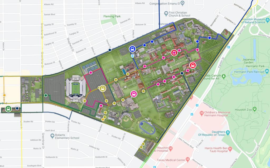
Many employees and students rely on public transportation to get to and from work or class every day. Integrating live transit feeds into your campus map is logical because people can easily understand where they are, where they need to be, and when the next bus or shuttle is expected to arrive. Rice University was among the first Concept3D clients to offer campus-wide live transit information, featuring a number of different bus routes and shuttles available for students across campus. Without the Concept3D mapping platform, these would be difficult to understand in a geographic context. With the live transit feed, students or staff can click on a certain bus stop or route and see exactly what time the next bus is arriving or departing, and even see live movement of buses.
Other Options
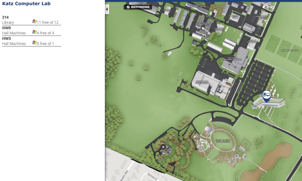
Live data integration has endless possibilities and can be as large or small as you’d like. One unique example of live data integration is Penn State’s computer labs. Penn State has integrated live data feeds in the majority of their computer labs across campus that showcases exactly how many computers are being used (and therefore how many are currently available) in real time.
Another use of live data feeds is parking. Arizona State University has an extensive parking information on their Concept3D map that is especially helpful during large events like football games or graduation. ASU’s map highlights the best places for visitors to park with color coded maps – red is full, yellow is filling up and green is wide open. Other parking information, like restrictions, are also provided.
There are many other examples of live data feed integration, from event updates to incredibly detailed ESRI data. Live data integration can be fully tailored to the needs of your campus and will benefit not only visitors but current employees and students as well.