On their own, interactive maps and virtual tours are powerful online tools for engaging your audiences. But when combined, these tools create a powerful and memorable online experience. The two different tools complement each other and strengthen the potential of the Concept3D platform, and offer visual, audio and text opportunities that appeal to all types of people.
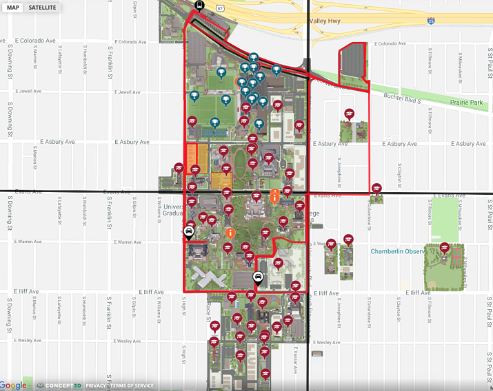
On their own, interactive maps are a fantastic digital method of bringing your physical spaces to life online, and provide schools and businesses with a visual and dynamic hub of information. By default, interactive maps are designed to make large areas like campuses easier to visualize and navigate, and ways to present information. Interactive maps offer an attractive, birds-eye view while allowing users can dig deeper to find the information they’re looking for.
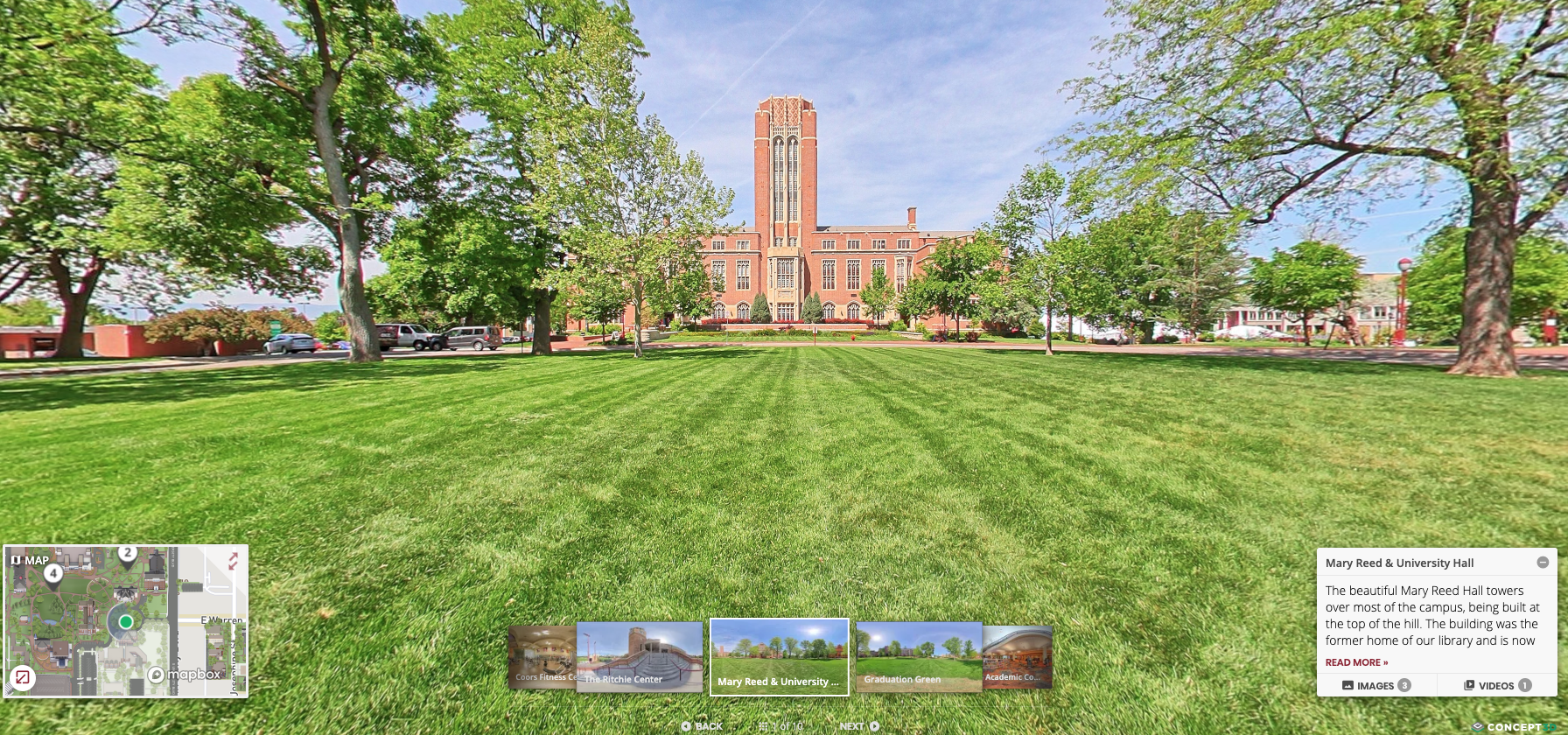
On the other hand, virtual tours offer the ability to create an extremely curated tour of the most important highlights. Step-by-step, virtual tours guide visitors through, and Concept3D’s virtual tour system offers audio narration, 360-degree video and photos, among other features, to create an immersive experience second only to being there. Our clients create virtual tours for many different reasons. From an education standpoint, universities often have a general, first-stop virtual tour of the campus, and then supporting tours that show dorm life, campus history, athletics, sustainability initiatives, recreation, among other applications.
Combining interactive maps and virtual tours offers the best of both worlds.
There are a number of campuses that use Concept3D’s interactive map and virtual tour, 360° Tours technology, including CoreSite data centers, Texas A&M University, and the University of Denver.
Our software allows both tools to be integrated into the same platform, so users can easily switch between both features. One example of this cohesion: each virtual tour (some campuses have several) have built-in mini-maps to orient the user and show the location of tour stops in relation to the rest of the campus. The mini-map can be toggled on or off to select and highlight different levels and aspects of a campus.
Both the interactive map or virtual tour can be tailored to your specific needs. For example, the University of Denver and Tarleton State University have integrated a virtual tour within their campus maps – but use them in different ways. The University of Denver has a virtual tour that is 10 stops and Tarleton State University’s tour is 26 stops. Both tours are incredibly detailed – Tarleton even introduces a tour guide, Tony, who you’re introduced to at the first tour stop. Tony is your narrator and guide throughout. Both 360° Tours were built using Concept3D’s Tour Builder.
Not only are these two features beneficial when used together on college campuses, but can be used for many different types of campuses, from healthcare facilities to data centers. For example, CoreSite uses interactive maps to showcase nine of its US facilities and a 360° Tour of a campus in Reston, Virginia. CoreSite’s interactive platform showcases its secure, high-performance facility features, as well as interconnectivity highlights, such as native access to networks and cloud services.
Both of these tools benefit business’ staff and visitors on their own – but the complementary can truly make a business or education campus come to life.