Today Michigan Technological University presents the benefits of an interactive map at High Ed Web. They are is a public research university, home to more than 7,000 students. Founded in 1885, the University offers more than 120 undergraduate and graduate degree programs. Our campus in Michigan’s Upper Peninsula overlooks the Keweenaw Waterway and is just a few miles from Lake Superior.
Michigan Tech has a rich history and gorgeous campus, the question is how to visualize the campus.
Buy In
MTU needed a software that was easy to use, accessible, vendor hosted, virtual tours, 360 panoramas, and a customized campus rendering. After figuring out who they wanted to hire for their campus visualization, MTU needed buy in from other departments to make this possible. They went around to the Risk Management, Graduate School, Institutional Equity, Undergraduate Admissions, transportation, facilities, and the housing departments to see if there was a need for an interactive campus map.
The consensus was yes, there was a need.
Important Features
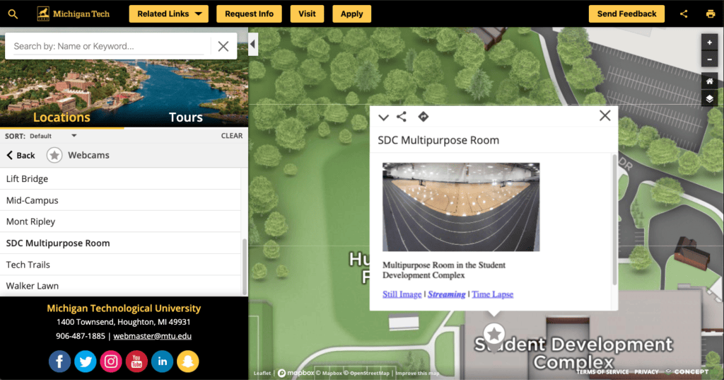
Embedded Webcams
MTU embedded live camera feeds all over the map to show off the most popular sites. People can feel connected to their campus without ever visiting. As well as giving current students to see how busy an area around the webcam is. This is a great example of how live data feeds can be integrated into an interactive map.
Category Information
MTU used their map to give critical and helpful information for on-campus and off-campus points of interest. So for a first time visitor, or even new student, can get familiar and feel like Michigan Tech and the city of Houghton are home.
Events
Having the ability to create specific categories for a huge confusing event like move-in day and weekend. The category was so successful on the actual day of the event parents were commenting on it in the event Facebook group.
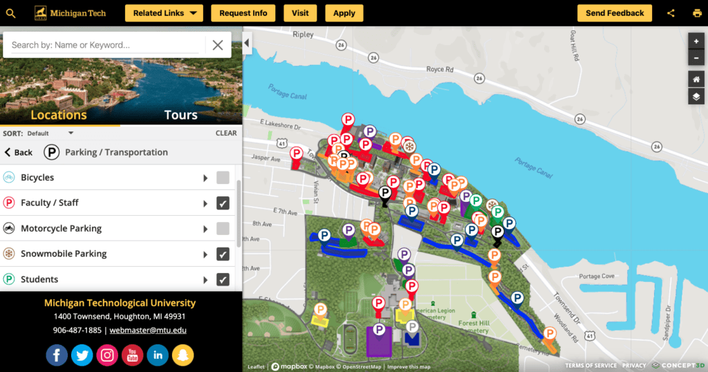
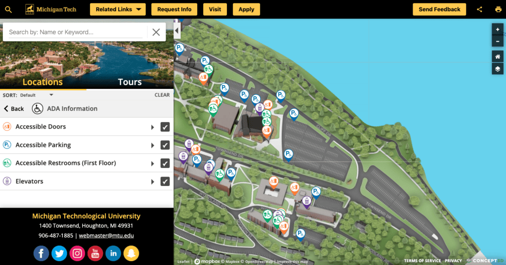
Parking
This category gives ability to students, visitors, and staff where they can or cannot park. Having the ability to color coat each parking area in relation to the permit colors. This feature shows how a content management system(CMS) can manage and display your digital media to help your end-user.
Amenities
Understanding what is available on campus before visiting, as well as grasping where everything is when you are new to campus. MTU uses their amenities category to give a full campus experience from every level of knowledge.
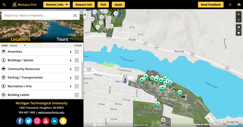
Community Resources and Recreation category
The map doesn’t just have to feature on campus activities. MTU features a community relations and recreation category to show off-campus areas like the local ski resort, grocery stores, banks, and even a golf course.

Accessibility
The map was an easier way to update pathways throughout campus. There was no need to upload floor plans, you can visualize and plot your route on the map. It gave MTU the ability to retire some old and outdated documents.
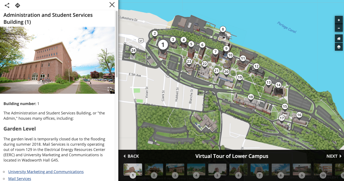
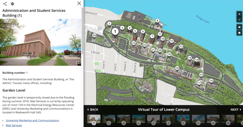
Map Tour
The virtual tours were created on the map to alleviate confusion for people who scheduled an admissions tour. MTU added a “tour” to show the prospective student where to park and start their in-person tour.
Wrap Up and Lessons Learned
Start with easy wins., convert existing information you already have about the campus by going through your current marketing materials. Gather additional information by going to your website to see what needs to be improved, and then speak to your staff about end-user needs. Make sure you go to all campus department to see what information they need in the map, then implement.
Identify audiences and campus partners who are familiar with the end-user needs. Break information down by what happens in a typical year, what confuses people the most, and how the map can make these events flow smoother with information.
Once the information is in the map and published to be public facing. Provide a feedback button to crowdsource information. The people who submit feedback can help rework how the map is displaying information. Find ways to link to and from the map on the associated website to get easy access to information for your end-user.
Michigan Tech’s map is the way it is for many reason, but the main one is buy in. When buying a map try to get as many departments involved to make sure that you USE the interactive map you bought. You should never buy something to not use it. Document information sources and event timing just to keep up and make sure everything is displaying correctly. Know that Concept3D’s fantastic Client Success Team quarterly call keeps your map from falling by the wayside.
Last but not least, can you find Blizzard the MTU mascot on the interactive map? If you can find Blizzard you get a prize, click here to contact someone.